Efficient, accurate and safe data capture
Mining operators who adopt drone technology quickly realize the significant added value it brings to their industry.
Namely, it improves the overall efficiency of large mine site and quarry management by providing accurate and comprehensive data of site conditions in a very short time. It also supports better coordination among teams onsite and internationally, offering dynamic oversight of all operations.
Above all, this data can be safely produced by on-site workers with minimal surveying experience at a fraction of the cost of traditional survey methods.
Drone data provides more precise volumetric measurements than traditional surveying methods, such as ground-based GNSS. This allows better valuation of stockpiles.
Highly accurate measurements
By providing thousands of data points for one stockpile, drone surveys are far more accurate than surveying with total stations. All surface unevenness and undulations are identified. The surveys make it possible to reduce the deviation in stockpile volume calculations, to generate improved base files for stockpiling, and to produce more accurate financial statements and regulatory checks.
350 x
more data points than with traditional GNSS survey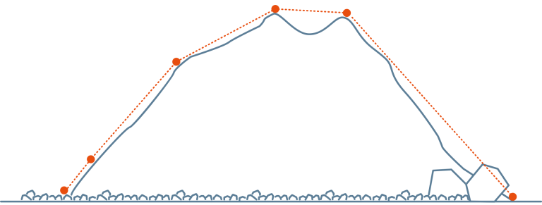
Only a few data points can be collected, craters and steep slopes are often overlooked.
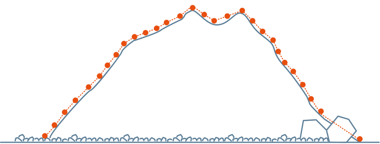
Hundreds of data points are collected, including steep slopes or craters sometimes invisible from the ground.
Faster and easily-repeatable surveys at low cost
Capturing data with a drone is up to 30 times faster than with traditional land-based methods and does not require the presence of a surveyor on site. You can easily collect the data yourself and at a frequency best suited to your site for rapid data turn-around. Changes between two surveys can be tracked and highlighted automatically. In the long term, the costs of surveying and monitoring are substantially reduced.
Up to30 x
faster data collectionImproving worker and site-safety management
Drones allow you to survey parts of the mine or quarry that are normally difficult to access with traditional surveying equipment. This eliminates the hazards employees typically face while walking through dangerous zones, navigating active sites or climbing onto stockpiles. All this without disrupting the flow of operations and movement of machinery.
100 %
safe surveying operations on siteAPPLICATIONS OF DRONES IN THE MINING INDUSTRY
Images from 3DR Site Scan platform
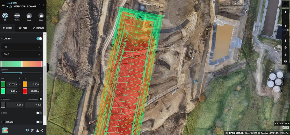
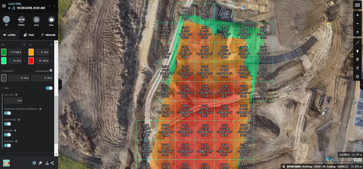
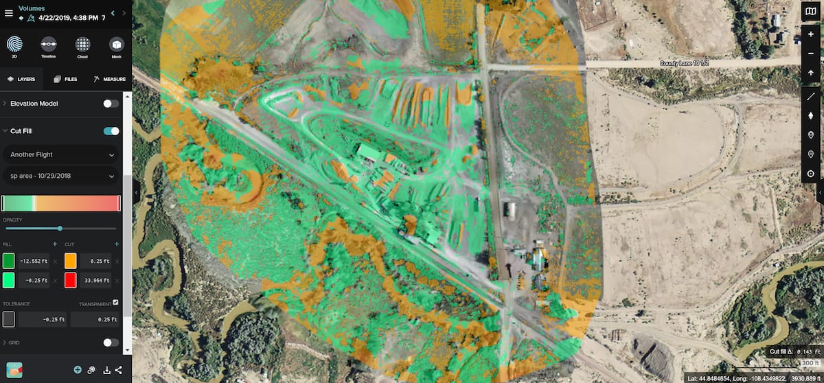
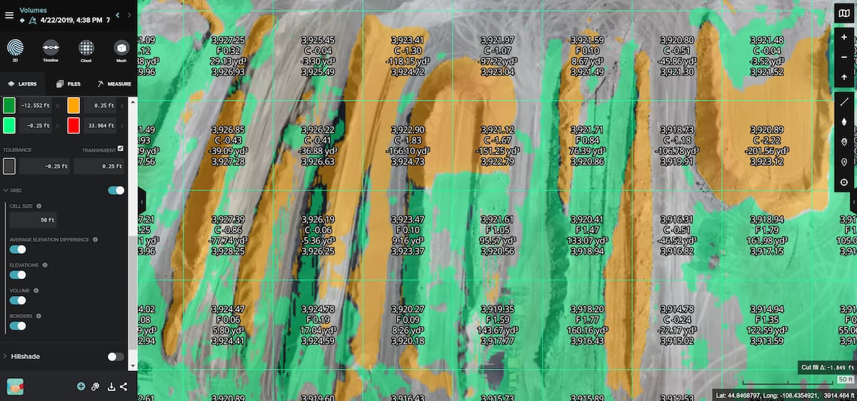
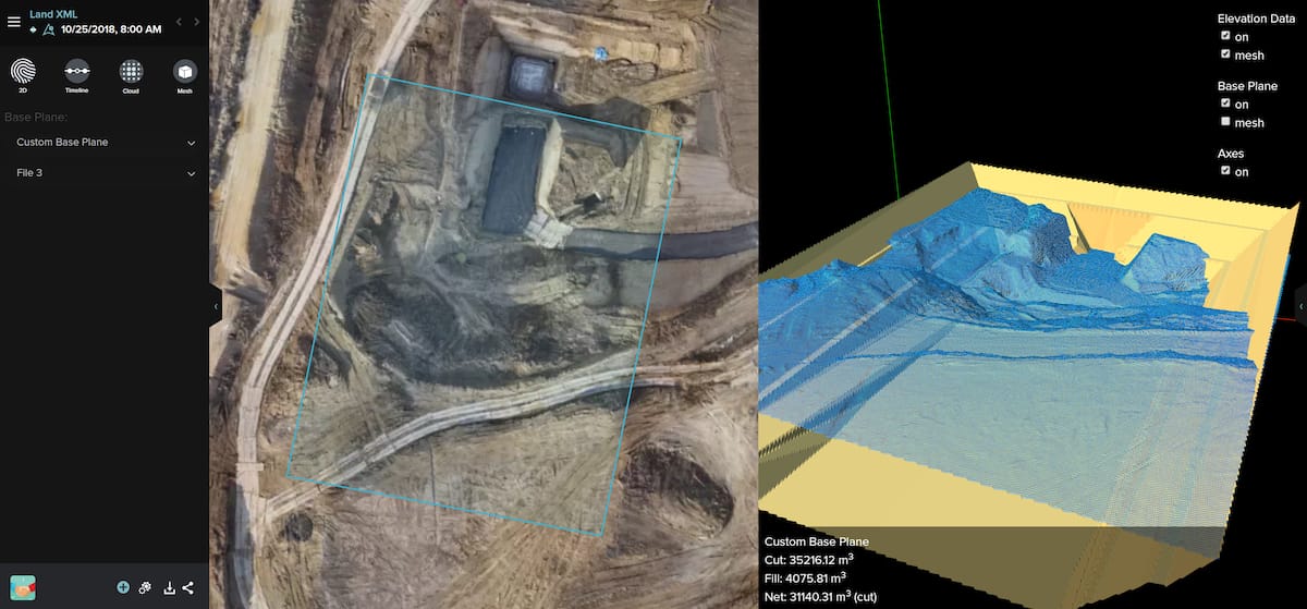
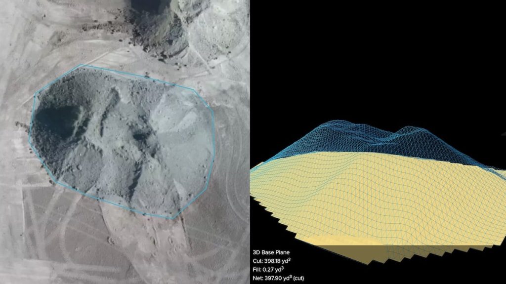
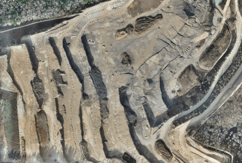
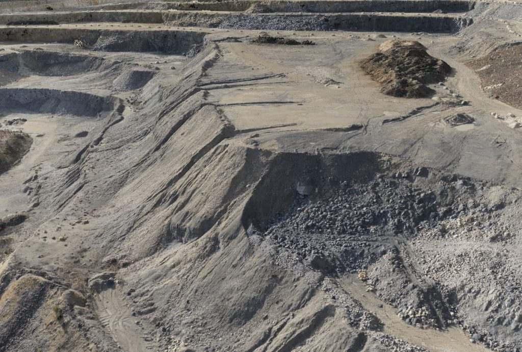
Stockpile inventory and management
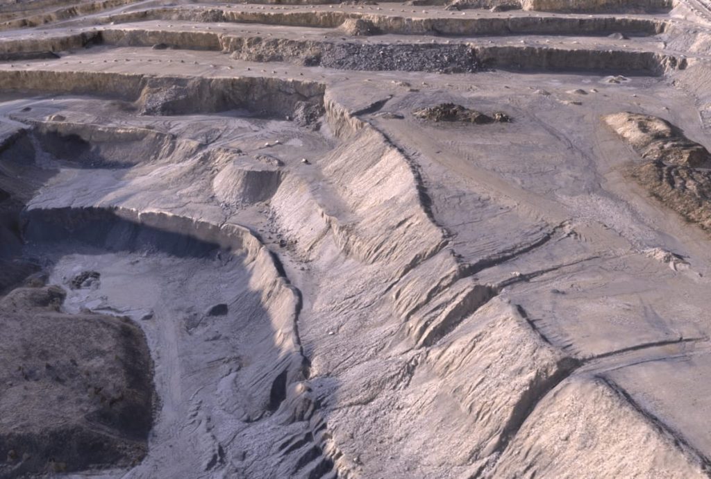
Since stockpiles are by nature irregular in shape and exhibiting craters, it is difficult to estimate their volume with great precision using traditional instruments such as ground-based measurements. These slow and costly methods also prohibit frequent surveys and can even threaten the surveyor’s safety climbing up and down the stockpiles or working in the middle of the machinery.
Given the speed at which inventory surveys can be conducted, frequent data collection is becoming cost-effective; be it weekly, monthly or quarterly. You can fly your site as often as you like. You do not need to wait for a semi-annual aerial survey. With these regular data collections, you improve inventory and operational management, while eliminating the risks associated with the surveyors working physically on the site.
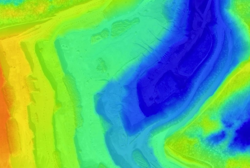
The drone aerial images can be used to generate a point cloud, digital surface model, digital terrain model and a 3D reconstruction of the site, including its stockpiles. As the point cloud contains several thousand data points, very accurate volume calculations can now be performed easily. You can now calculate the value of stockpiles for monthly reconciliations or year-end audits with high accuracy and thus improve the consistency of the inventory reports in the company’s balance sheet. You can also validate the amount of material moved by subcontractors as the drone results and postprocessing hardware are unbiased.
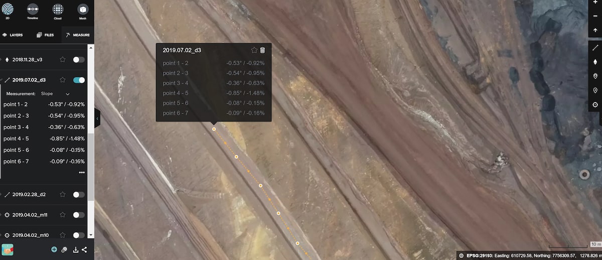
Display of slope, degrees and percentages from point to point.
Haulage roadsAerial images of the site enable also regular visual assessment of the state of the haulage roads. They provide valuable data such as road length, slope and turning angles allowing roads to be checked against design requirements or current legal standards allowing you save costs on fuel and ensure that your mine is within planning and regulatory requirements.
Mine or quarry monitoring and operation planning
With an accurate site model produced out of drone aerial images, mine managers can now more efficiently design and manage site operations while collaborating across teams. This is because you assess more accurately the volume of material that must be extracted or moved according to concept or legal standards. The digital elevation maps produced by the images can also be used to model sediment flow and plan tailings pond operations. Because it is possible to fly frequently with a drone, you can create a visual record of the site over time and monitor progress on a weekly or monthly basis.
Assessment before and after drilling or blasting

Hazard identification and mitigation

The data outputs of WingtraOne are post-processing software agnostic, therefore compatible with any post-processing solutions and existing workflows.
Orthomosaic maps
Drone images are used to recreate a highly-accurate orthomosaic map of the mining site or quarry. Each pixel contains 2D geo-tagged information (X, Y) and can be used for distance and surface measurements.
3D point cloud
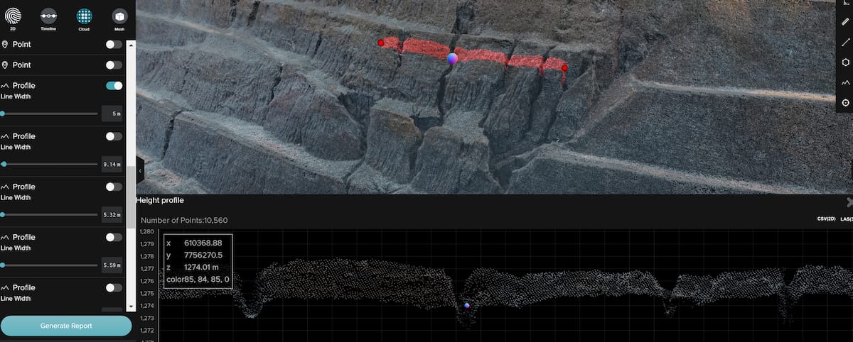
A densified point cloud can be generated from the drone images. Each point contains geospatial (X, Y, Z) and color information. It provides a very accurate model of the site for precises volume measurements and visual aid in future planning.
Digital terrain model (DTM)
After filtering objects such as buildings, machines and conveyor belts, the drone images can be used to create digital terrain models with each pixel containing 2.5D information (X, Y, and Z value of the highest altitude). These models allow you to identify stockpiles and pit changes or to model water flows and wall collapses.
3D textured mesh
3D textured mesh is a reproduction of the edges, faces, walls, vertices and textures of the area taken by the drone. This visual depiction of a quarry or mining site is most useful for inspecting unreachable areas such as pits and slopes.
Efficient, accurate and safe data capture
Conduct quick and efficient first inspections on your projects. Use drone technology to eliminate equipment to reduce cost and time of setting up equipment to gain a new view of your project.
Using a drone can vastly reduce the time spent collecting accurate data. By acquiring faster data from the sky in the form of geo-referenced digital aerial images, you can gather millions of data points in one short flight.
With TGG Drone Services you can capture accurate aerial imagery and transform it into 2D orthomosaics (maps) and 3D models of small-and medium- sized sites.
UAV's can capture highly accurate images of your fields, covering up to hundreds of acres in a single flight without the cost and hassle of manned services. Agriculture mapping helps spend less time counting and more time treating the plants for you to boost yields and cut costs.